(by Nate)
For all who have been asking for pictures and that have so patiently waited. Here they are!! I never cease to be amazed at the beauty of the earth that Heavenly Father has created for us. The variety of landscape and the will to live manifest through all living things is astounding. Even in the harshest environments, those that are consigned to reside year round are able to adapt and thrive. How thankful I am to the Lord for the beauty of the earth.

These 1st two were my first 135 flight (my 1st flight that I took passengers for hire). I took two guys out across Bristol Bay to the West Side. They buried the ashes of their uncle. There are 2 sections of floats off of the old style fish nets cause he was one of the 1st fishermen that started up in Bristol Bay.

And a bottle of ketchup since he put it on everything he ate. It was fun to be a part of that with them. Afterwards they wanted to go sightseeing for a bit. We saw a huge bull moose on the way home.

This is looking NEast from Puale Bay. I have been flying with a couple of geologists for the last couple days. They have wanted to go to a bunch of different sites and look at the rocks and look for signs of petroleum. It has been pretty fun learning about geology and how to read the rocks.

NEast side of Puale bay

Puale Bay

Puale Bay

Puale Bay

Puale Bay

Puale Bay

Puale Bay

Puale Bay

Puale Bay

Cape Kekumoi

Cape Kekumoi

Cape Kekumoi (looking NEast)

Fossils we found

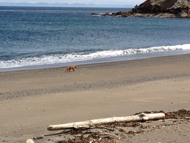
This fox just came trotting down the beach without a care in mind, when suddenly he finally noticed me and stopped. He stopped right in front of me and just starred for almost a minute. As I was joking with him that I could have shot him dead 3 or 4 times by now and that he should be more careful, I realized that I should probably be taking a picture. By the time I got the camera out he had walked off a bit.

This is looking south from Cape Kekumoi

More fossils


Looking South across Puale Bay


Looking South across Puale Bay

1st brown bear I saw. He's in the center climbing up.

Another shot of the bear. Hopefully I will be able to get a good shot of one sometime (without getting eaten, haha!).
Look closely and you will see airplane wreckage. A WWII B-17, well, what's left of it anyway.

More B-17 parts

More B-17 parts

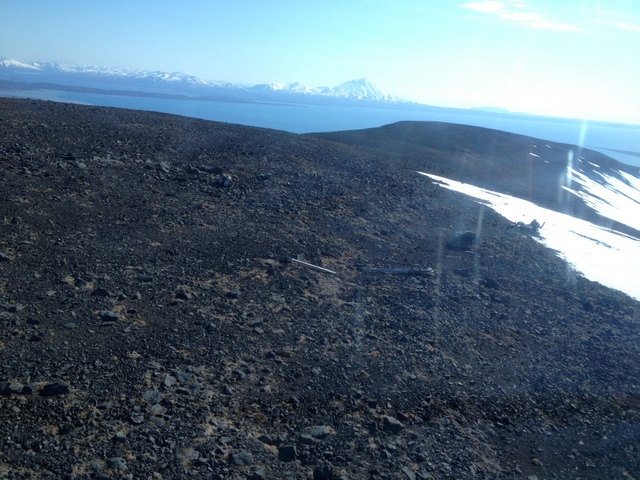
-Just east of Whale Mt, looking across Becharof Lake (2nd largest lake in Alaska) at Mt Peulik.

My cute baby. How do they feel comfy in these sorts of positions?

SWest side of Becharof Lake. The big mountain is Mt Peulik. The formation to the left of Mt Peulik is called Gas Rocks.

Gas Rocks

Close up of Mt Peulik

Crater at the bottom of Mt Peulik

Looking west on the south side of Becharof Lake. Pretty flat and boring.

Gas Rocks, so named for the CO2 that bubbles out of the ground around it.


Heading SEast out of Ugashik Crater

An old oil camp from 1902ish time frame. You can see the old boiler in the middle of the rubble.

Looking North. Off the North side, across the creek to the North side of the valley and to the left of the tributary is an oil seep.

Coming out of the pass into Wide Bay

Brown bear running across the open tundra. (Blackish dot left of the 3rd creek up from the bottom)

5ft deep pit that the natives used to cover with wood and sod to make a house. Its hard to see.

Big bear track!


SWest side of Coal Pt. looking south

SWest side of Coal Pt. looking SWest

Big sea cave


Can you find the eagle's nest?

Looking south down Wide Bay

Ugashik Crater

Ugashik Crater

Ugashik Crater

Ugashik Crater

Ugashik Crater
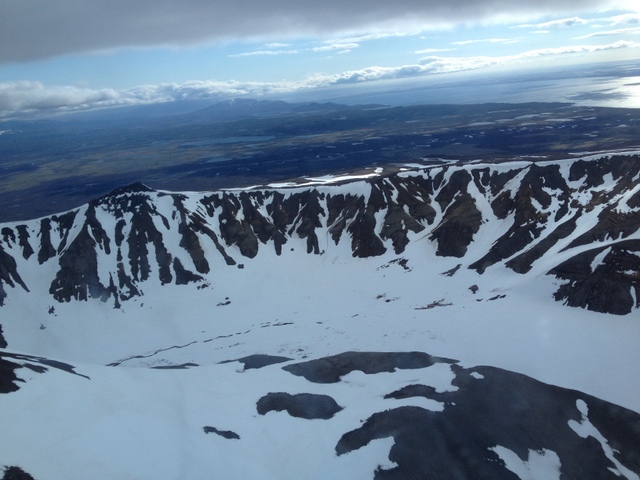
Ugashik Crater. Upper Ugashik Lake in background

Entering the Valley of Ten Thousand Smokes

Lake behind Dakavak Bay

Seals watching us on their beach

Another seal. There were about 4 or 5 watching us at any one time.


I think this is a wolf but not sure. Just a track in the sand, not a fossil.

Fossilized bullet

Sand trunks. Little pillars of sand that are somehow growing up.

Looking down the valley of Ten Thousand Smokes.

Bottom of Ten Thousand Smokes. The entire valley floor is covered in this ash flow from the last eruption in 1912.

The rivers make it look like a miniature Grand Canyon. Three Forks overlook is on the hill.

Looking up the valley of the Little Ugashik river. The oil seep is behind and to the left on the north side.

Some interesting plants that look like they will flower soon.